Ordnance Survey marks 225 years of mapping Britain
Summarised from 2 outlets · Updated 8 Nov, 17:54 · Archive
The Ordnance Survey marks 225 years since its first county map of Kent, completed in 1801. The ten-year project began as a military mission prompted by fears of French invasion during the Napoleonic wars. The Board of Ordnance launched the first survey in 1791 to map vulnerable areas along the southern coast, and Kent became the initial focus.
Surveyors used highly specialised instruments, including precision theodolites for measuring triangles, along with measuring chains and notebooks to map the difficult terrain. The process was described as 'a wild and arduous exercise', conducted in challenging weather conditions. What began as a military undertaking eventually expanded across almost a century to cover the entire British Isles.
Mapping technology has transformed dramatically since then. Today, a survey that took ten years in 1801 can be completed in just ten days, with modern equipment using satellites, GPS and digital technologies. The organisation's work has expanded far beyond its original military purpose and now serves a wider population through both commercial and recreational use.
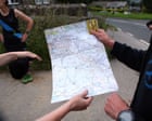
How it is being reported
- The Guardian view on Ordnance Survey maps: still a superior way to navigate the landscape | EditorialThe 225th anniversary of the organisation’s first publication is an opportunity to celebrate its unique contribution to our sense of place In his one-paragraph short story , On Exactitude in Science, Jorge Luis Borges imagines an empire in which the level of cartographical ambition is so high that a map is made on a one-to-one scale with the imperial territory. The quest for perfect accuracy doesn’t end well. But the earliest map-makers for Ordnance Survey, which this week marked the 225th anniversary of its first publication, might have empathised with the obsessive dedication. The 1801 OS…The Guardian · 8 Nov, 17:25
- As the Ordnance Survey celebrates its 225th birthday, how it transformed the way Britain is mappedIt took ten years to map Kent in 1801. Today, the same job can be completed in just ten days, as Ordnance Survey marks 225 years since its first county map and looks towards the future of mapping. "As our navies were elsewhere in the world, they were worried that Napoleon might come and invade," said OS chief executive Nick Bolton. "If they were going to do that, we'd better know where the south coast is." He continued: "So, our first map was of Kent, and then we worked around the south coast." What began as a military mission to protect Britain's coastline has since developed into one of…GB News · 7 Nov, 06:00
In this story: Ordnance Survey · Kent · Nick Bolton · Britain · France
This summary was written by AI from the headlines and standfirsts above, and states as fact only what at least two outlets report. How we use AI · Report a problem · Corrections log
Comments (0)