Late-season storms possible in eastern Nebraska on Monday
Summarised from 2 outlets · 6 reports · Updated 3 Nov, 11:56 · Archive
Strong storms with severe wind gusts are possible across eastern Nebraska on Monday evening as an unusually warm and humid day precedes a cold front.
An unusually warm and humid Monday with temperatures climbing into the low to mid-70s and dew points in the 60s is creating atmospheric conditions favourable for thunderstorm development across eastern Nebraska. A cold front pushing through the state will trigger storm development, particularly in areas west of Omaha where conditions are most unstable.
A marginal risk for severe weather (Level 1 out of 5) has been issued for southeastern Nebraska, with the best chance for strong to severe storms remaining tight to the cold front. Isolated stronger storms could develop along the front, stretching from near Sioux City down toward the Superior area. Strong wind gusts are the primary concern, with some gusts over 60 mph possible from individual storms. A brief tornado is also possible, though meteorologists note that the shallow wind shear would work against any rotation becoming strong or long-lived.
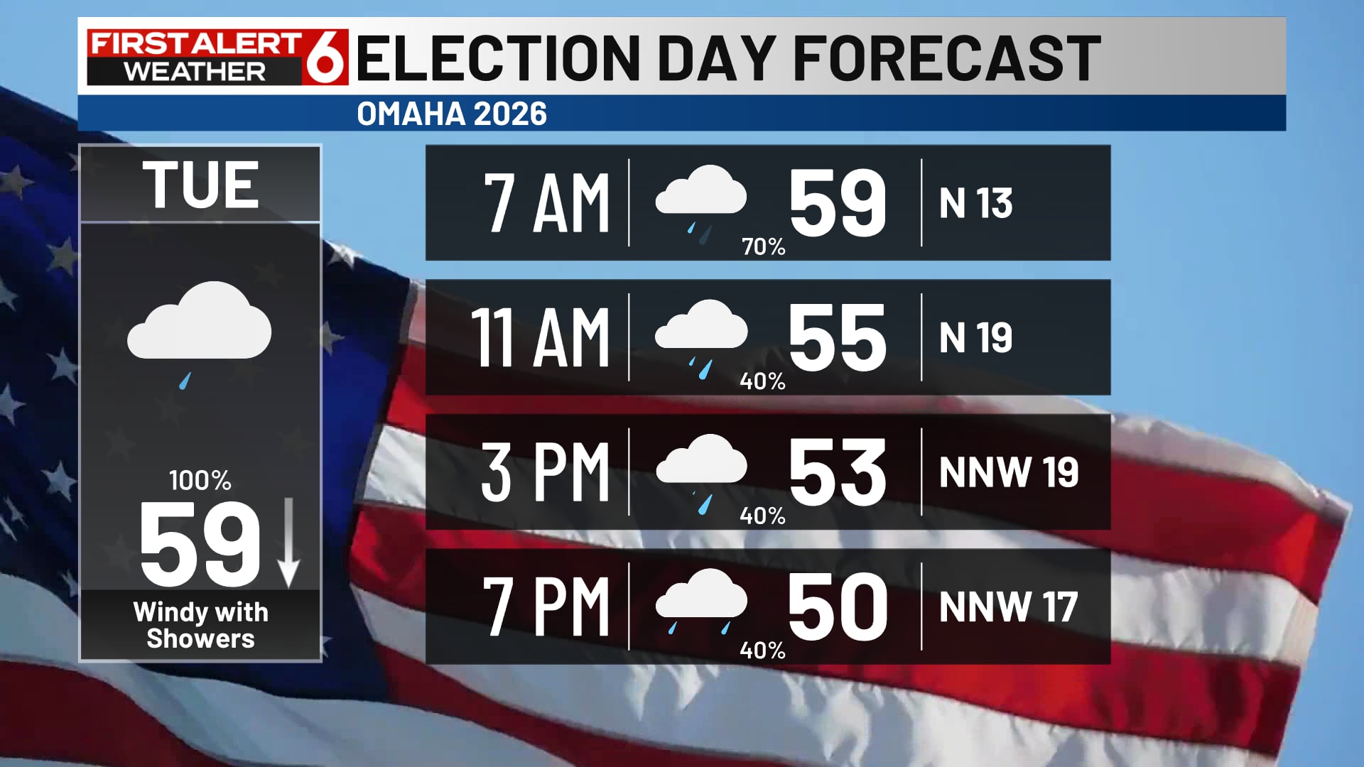
Storms are expected to reach the Omaha metro around 8pm, with the peak window for activity between 4 and 10pm. Severe weather chances are lower in Omaha itself, though strong winds remain possible. The severe threat will diminish after midnight as storms push eastward. Rounds of rain will continue overnight and into Tuesday morning, with some areas receiving over 1 inch of rainfall. On Tuesday, temperatures will fall significantly as north winds kick in, with highs in the upper 50s to low 60s.
How it is being reported
- Rusty’s First Alert 6 Forecast: Rounds of rain & wind on Election DayTemperatures fall through the day tooWOWT · 3 Nov, 11:30
- Matt’s First Alert 6 Forecast: Storms Monday evening, more rain and wind TuesdayStrong storms possible Monday evening, mainly west of OmahaWOWT · 2 Nov, 21:54
- Late-season isolated severe threat across southeast Nebraska; chilly day with lingering rain TuesdayAn unusually warm and humid Monday is setting the stage for a late-season severe weather threat this evening across eastern Nebraska.1011Now · 2 Nov, 20:29
- Rusty’s First Alert 6 Forecast: Rain & storms on a windy, muggy and warm November dayTemperatures climb into the lower 70sWOWT · 2 Nov, 11:39
- Matt’s First Alert 6 Forecast: Wind, warmth, storms Monday, showers on Election DayStrong winds, warm air, and storms in Omaha MondayWOWT · 2 Nov, 00:09
- Bo’s First Alert 6 Forecast: Severe evening storms possible on Monday, a dreary Election DayThe best chance of severe weather is mainly after 5 PM on Monday.WOWT · 1 Nov, 13:24
In this story: Omaha · eastern Nebraska · southeastern Nebraska · Kansas · southwest Iowa
This summary was written by AI from the headlines and standfirsts above, and states as fact only what at least two outlets report. How we use AI · Report a problem · Corrections log
Comments (0)