Nebraska braces for severe thunderstorms and heavy rain
Summarised from 2 outlets · 4 reports · Updated 3 Nov, 21:51 · Archive
A strong storm system will bring showers and thunderstorms across Nebraska, with severe weather possible in eastern areas.
A strong storm system is moving across Nebraska, bringing showers and thunderstorms through Tuesday. A marginal risk of severe thunderstorms exists for eastern Nebraska on Monday afternoon and evening, with the primary threat being damaging winds of 60 mph. Isolated tornadoes are possible, and large hail cannot be ruled out.
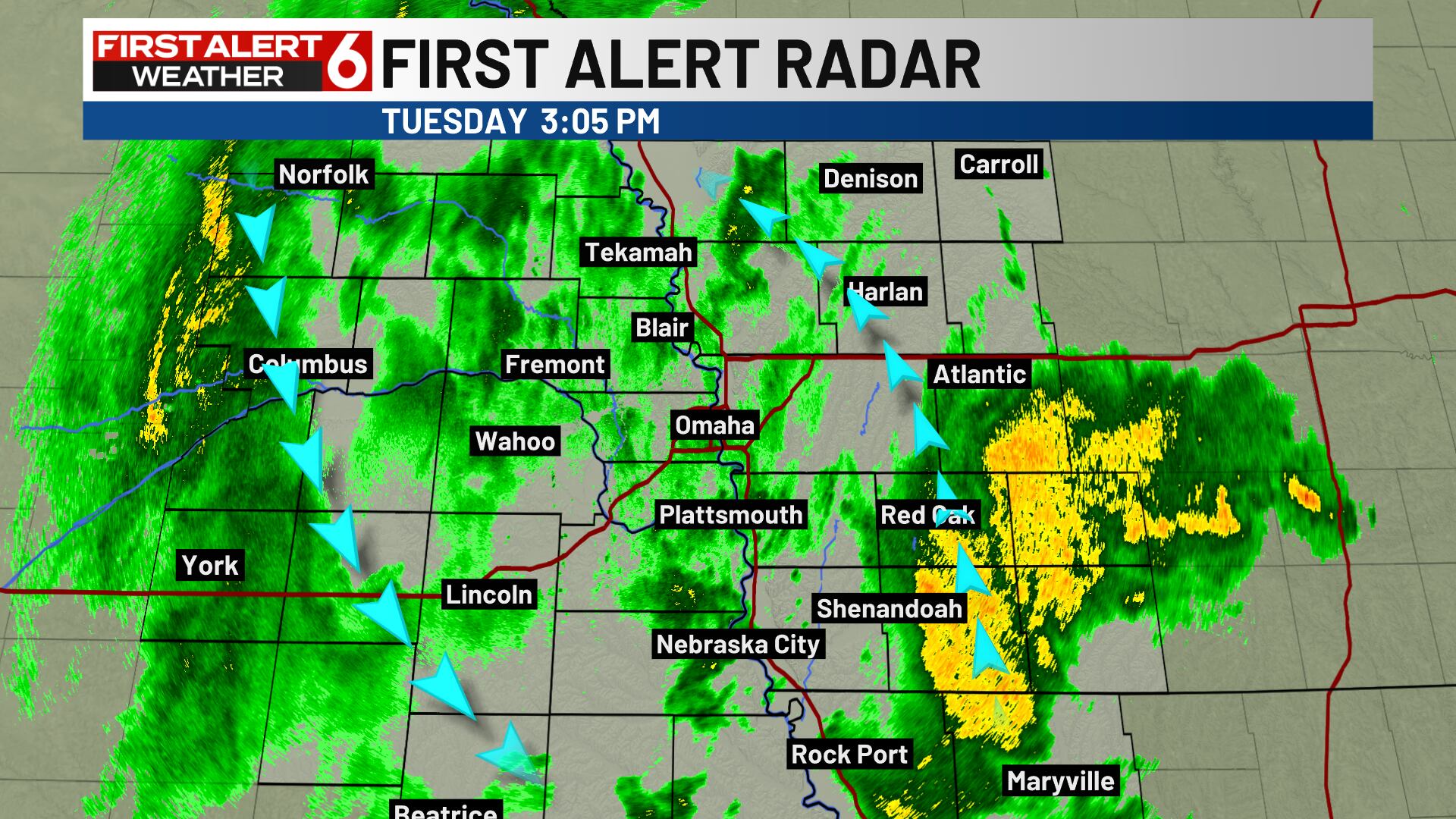
Rainfall amounts vary across the state. Some parts of Nebraska could accumulate up to 1.5 inches of rain from Sunday evening through Tuesday evening, whilst the Lincoln area is looking at 0.25 to 0.75 inches. Parts of eastern Nebraska, particularly Platte and Polk county, have already picked up soaking rain in the 24 hours before Tuesday, with totals between 2 to 4 inches, whilst the Omaha metro area has seen 0.5 to 1 inch.
Windy conditions will accompany the rainfall, with south winds gusting to around 40 to 45 mph Sunday night and Monday, shifting to northwest winds by Tuesday. Temperatures will be well above average Sunday night, followed by warm conditions Monday in central and eastern Nebraska. Tuesday will be cooler and windy, with highs ranging from the upper 40s to around 60. The system should clear by Thursday, with drier conditions expected thereafter.
How it is being reported
- Matt’s First Alert 6 Forecast: Showers, drizzle linger through midweekShowers and more gusty winds Tuesday evening into WednesdayWOWT · 3 Nov, 21:34
- Cool, windy and rainy TuesdayRain is likely for much of the day in the eastern half of the area.1011Now · 3 Nov, 13:32
- Severe Thunderstorms Possible Today, Rain Likely TuesdayStorm system and cold front will bring showers and thunderstorms to the area the next couple of days.1011Now · 2 Nov, 13:32
- Rain and thunderstorms Sunday night and MondayShowers and thunderstorms expected Sunday night and Monday.1011Now · 1 Nov, 23:08
In this story: Nebraska · Eastern Nebraska · Lincoln · Omaha
This summary was written by AI from the headlines and standfirsts above, and states as fact only what at least two outlets report. How we use AI · Report a problem · Corrections log
Comments (0)