Cold front brings rain and wind, then significant cool down
Summarised from 2 outlets · 3 reports · Updated 15 Oct, 18:32 · Archive
A strong cold front moving through the region tonight will bring rain and gusty winds, followed by a sharp temperature drop with the season's first frost possible this weekend.
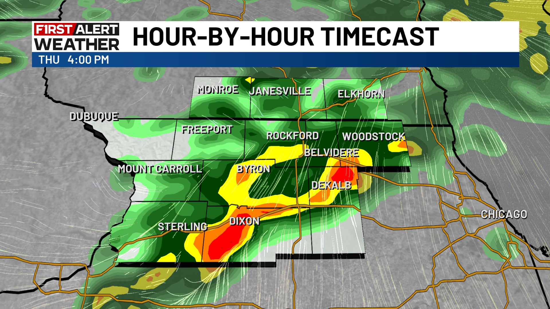
Rain is affecting the region this morning with scattered showers moving across the area. Light showers will give way to steady and at times heavy rain through the afternoon and evening, with rain totals expected to range from 0.25 to 0.75 inches across northern Illinois, with locally higher amounts up to 1 inch possible. An isolated strong storm cannot be ruled out for northern counties in south-eastern Missouri and southern Illinois around the Mount Vernon area to Perryville.
A strong cold front will move through tonight, bringing a dramatic shift in conditions. Winds will shift to the northwest and increase significantly, with gusts reaching 30 to 40 mph on Friday. A few wrap-around showers are possible throughout Friday as the low pressure departs to the northeast.
Temperatures will drop sharply behind the cold front. Highs on Friday and Saturday will be in the upper 50s to low 60s, with wind chills in the 30s expected during Friday evening. Overnight lows will dip into the 30s, with some places reaching 32 degrees. This will likely bring the season's first frost or freeze by Saturday morning.
Conditions will warm back to average early next week as winds shift to the south on Sunday, with temperatures expected to rebound into the 70s by Tuesday.
How it is being reported
- A strong fall storm system brings rain, wind, and frost to the statelinePeriods of rain today, becoming windy late tonightWIFR · 15 Oct, 18:16
- A few showers remaining, chilly weekend aheadRain for some this evening, windy conditions tomorrow, and a cool weekend.Kfvs12 · 15 Oct, 16:59
- Rain chances linger today, big weekend cool downHit or miss showers continue ahead of a strong cold front moving in tonight.Kfvs12 · 15 Oct, 09:49
In this story: Heartland · Illinois · Missouri · Ohio River · Rockford · Mount Vernon · Perryville
This summary was written by AI from the headlines and standfirsts above, and states as fact only what at least two outlets report. How we use AI · Report a problem
Comments (0)