Central Florida faces scattered storms with tropical moisture lingering
Summarised from 2 outlets · Updated 10 Oct, 20:19 · Archive
Tropical moisture from Isaias will bring scattered thunderstorms with heavy rain to Central Florida on Saturday and Sunday.
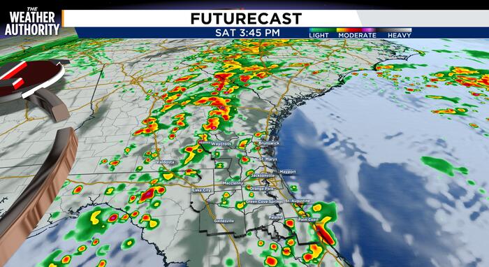
Tropical moisture trailing from Isaias will bring scattered thunderstorms to Central Florida on Saturday and Sunday. High temperatures on Saturday will reach the low 90s, with feels-like temperatures around or exceeding 100°F due to extremely humid conditions. Storms are expected to begin developing around noon, starting along the Interstate 75 corridor and southern Osceola county, with activity moving north towards the Orlando metro area around 2-3pm and continuing through the early evening.
While storms will not be as widespread or persistent as recent days, they will bring heavier rainfall and lightning. Wind will push storms from southwest to northeast. Tornado chances remain until 9pm in parts of Southeast Georgia and Northeast Florida, with severe thunderstorm warnings issued for parts of Clay, Saint Johns and Duval counties until at least 3:30pm. Thunderstorms should end by 11pm, though some rain may continue into early Sunday morning.
Sunday will see similar conditions, with scattered storms developing around noon and lingering into sunset, with highs in the upper 80s to low 90s. As Isaias moves into the Northeast by Monday morning, dry air will move into Central Florida, clearing rain chances and lowering humidity for the week ahead.
How it is being reported
- More Thunderstorms, Flooding with Low Tornado Risk remains for Saturday afternoonTornado chances remain through 9 PMNews4Jax · 10 Oct, 19:41
- Scattered tropical downpours for SaturdayWhile not as persistent as recent days, storms Saturday will feature heavier rain and lightning.Clickorlando · 10 Oct, 12:46
In this story: Central Florida · Isaias · Orlando · Interstate 75 · Osceola county · Northeast Florida · Southeast Georgia
This summary was written by AI from the headlines and standfirsts above, and states as fact only what at least two outlets report. How we use AI · Report a problem
Comments (0)